GTA 6 Map: Full Leonida Map With Every Name
What is on the full GTA 6 map?
The full GTA 6 map covers Leonida, a fictional Florida with six regions: Vice City, the Leonida Keys, Grassrivers, Port Gellhorn, Ambrosia and Mount Kalaga. In-game, the state is split into counties, including Vice-Dale, Kelly, Leonard and Mariana. When the story begins, only the Key Lento area is unlocked.
"Gta 6 full map" was one of the fastest rising searches in India on launch night. We get why. Every pre-launch map was a guess. So we pulled the real names from launch streams by GamerFleet, CarryMinati and players in New Zealand, and put them on one map.
GTA 6 map with names
Here is Leonida with every name we could confirm. Region and county names are official. Positions are our best estimate until the whole in-game map is unlocked, and we will redraw it then.
- Regions (Rockstar Games): Vice City, Leonida Keys, Grassrivers, Port Gellhorn, Ambrosia, Mount Kalaga.
- Counties (in-game map): Vice-Dale, Kelly, Leonard and Mariana.
- Water (in-game map): the Atlantic to the east and the Leonida Straits to the south.
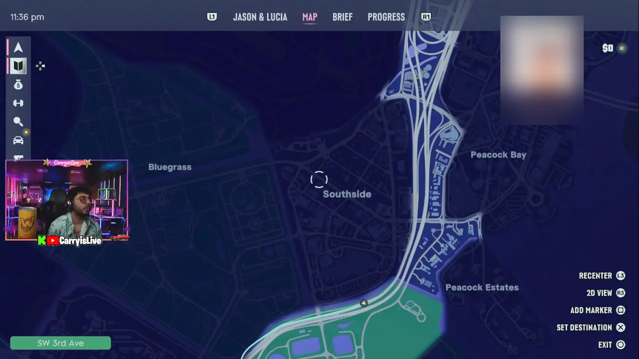
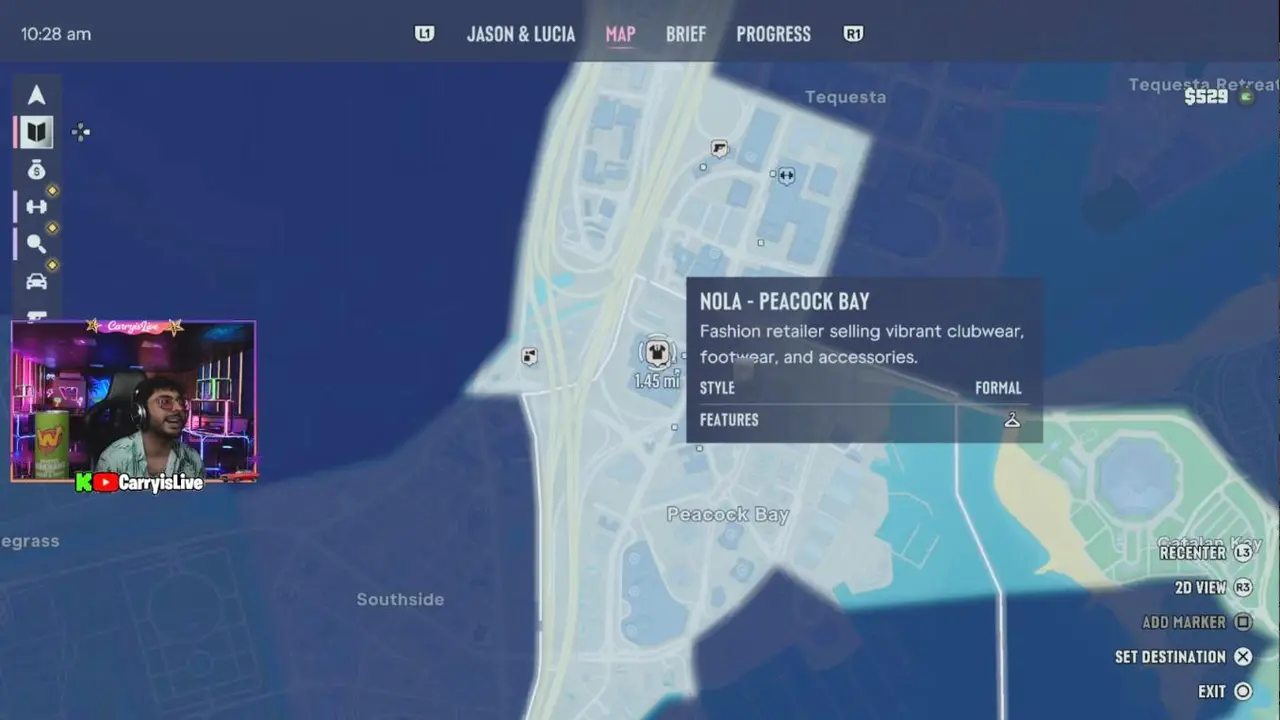
- Places seen in game: Key Lento, Sunbelt Hwy, Southside, Bluegrass, Peacock Bay, Peacock Estates.
- Added on launch day: Hamlet and Cottonmouth Lake, where players found Bigfoot, plus Tequesta north of Peacock Bay from CarryMinati's map.
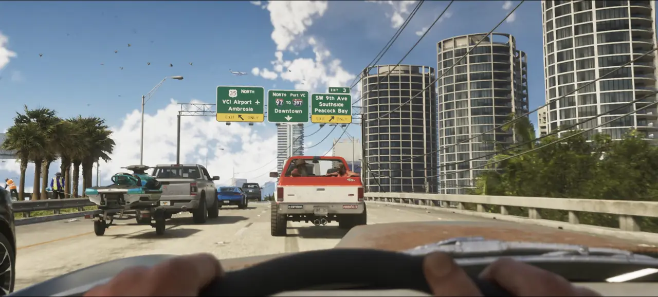
- Places on Trailer 2 road signs: VCI Airport, Downtown, Port VC and Ambrosia.
Why is most of the GTA 6 map locked at the start?
Because the story opens it up bit by bit. On a new save, only the Key Lento area in Mariana County is lit. Zoom out and the rest of Leonida is dark, with only county borders and names showing.
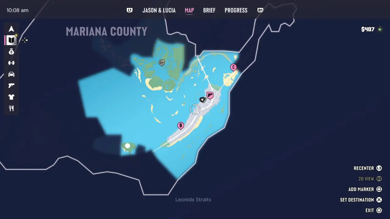
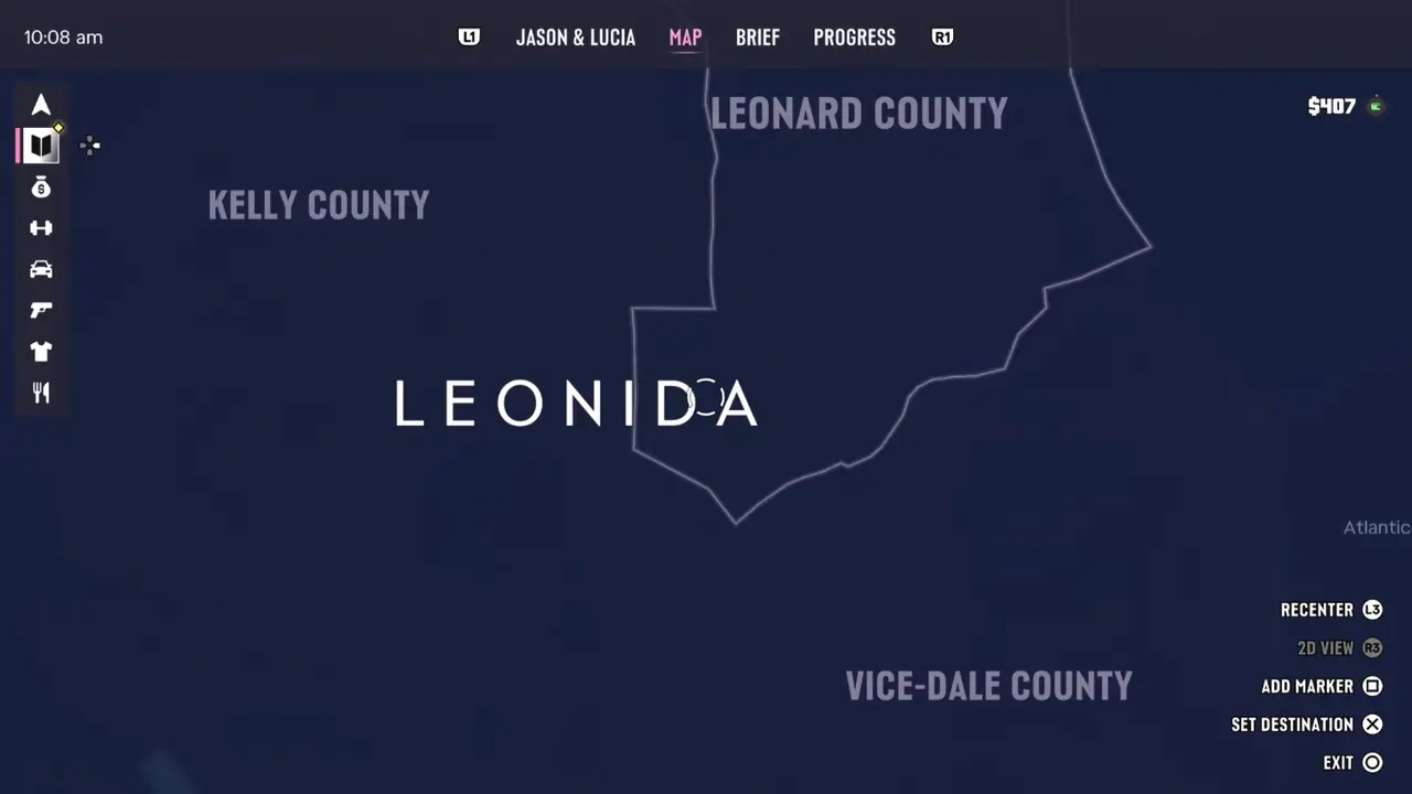
It keeps the opening hours focused. A few hours into CarryMinati's stream, the map already showed Southside and Peacock Bay with street names, so new areas come quickly once the story gets going.
What are the six regions of the GTA 6 map?
Leonida has six named regions. Each borrows from a real part of Florida.
| Region | Real place it echoes | What it feels like |
|---|---|---|
| Vice City | Miami | Beaches, neon, nightlife and the densest traffic in the game. |
| Leonida Keys | Florida Keys | Islands linked by long bridges. Boats, water and small bars. |
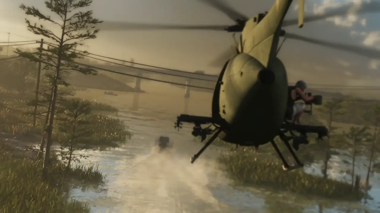
| Grassrivers | The Everglades | Wetlands, airboats, alligators and few witnesses. |
| Port Gellhorn | Florida Panhandle | A worn-down gulf coast port town. |
| Ambrosia | Inland sugar country | Flat farmland and a refinery town. |
| Mount Kalaga | North Florida forests | Woods, trails, hunting and fishing. |
What are the counties in GTA 6?
The in-game map names four counties so far: Mariana, Vice-Dale, Kelly and Leonard. Regions are what people call places. Counties are how the map itself is divided.
- Mariana County: the Keys, including Key Lento where the story starts.
- Vice-Dale County: the southeast, home to Vice City.
- Kelly County: the west side of the state.
- Leonard County: the north and center.
This isn't complete yet. More county names should appear as players unlock the north.
Which Vice City areas are on the map?
So far we have spotted Southside, Bluegrass, Peacock Bay and Peacock Estates on the in-game map, plus Tequesta and Tequesta Retreat to the north, with SW 3rd Ave running through. Trailer 2 road signs add VCI Airport, Downtown and Port VC, and reviewers mention the upscale Capri.
Where are Hamlet and Cottonmouth Lake in GTA 6?
Hamlet is a small farm town on the southern edge of the mainland, south of Vice City and just northeast of the Grassrivers. Cottonmouth Lake sits just below it, according to Insider Gaming. Both shot up in searches on launch day because that is where players found Bigfoot.
- Getting there: community mappers at GTA Six Map say the road south out of Hamlet crosses the water to Key Lento, so it is one of the first mainland towns you reach.
- Real-world match: fan mapping sites compare Hamlet to Homestead, Florida, the farm city between Miami and the Keys.
- What to listen for: near Cottonmouth Lake, a deep growl means Bigfoot is close. Insider Gaming says you can reach it early in the story.
Rockstar Games has not published a full official map, so our pins for both are approximate. We will move them once the whole in-game map is unlocked.
How big is the GTA 6 map?
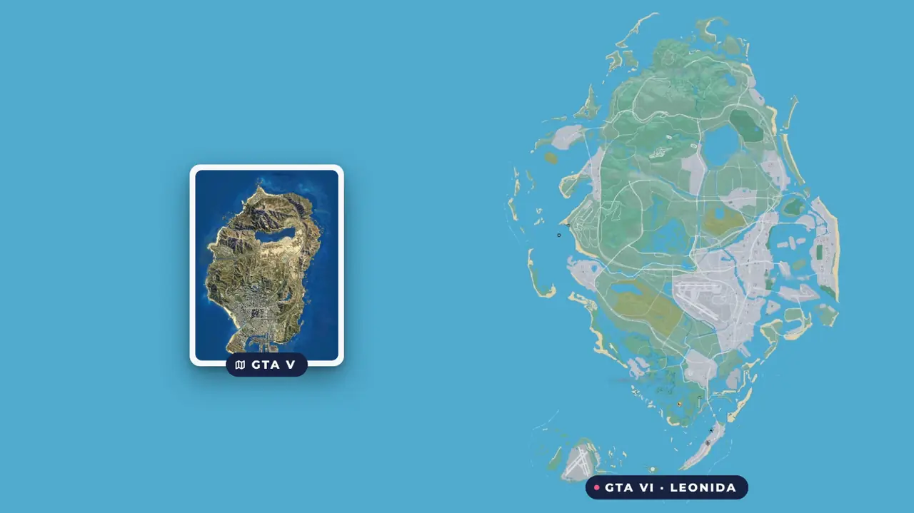
Bigger than GTA 5, with far more water. Rockstar Games has not given a number, so every square-mile figure online is an estimate. Side-by-side comparisons, like VladyCam's, show the GTA 5 map fitting inside Leonida with room to spare.
How does the in-game map work?
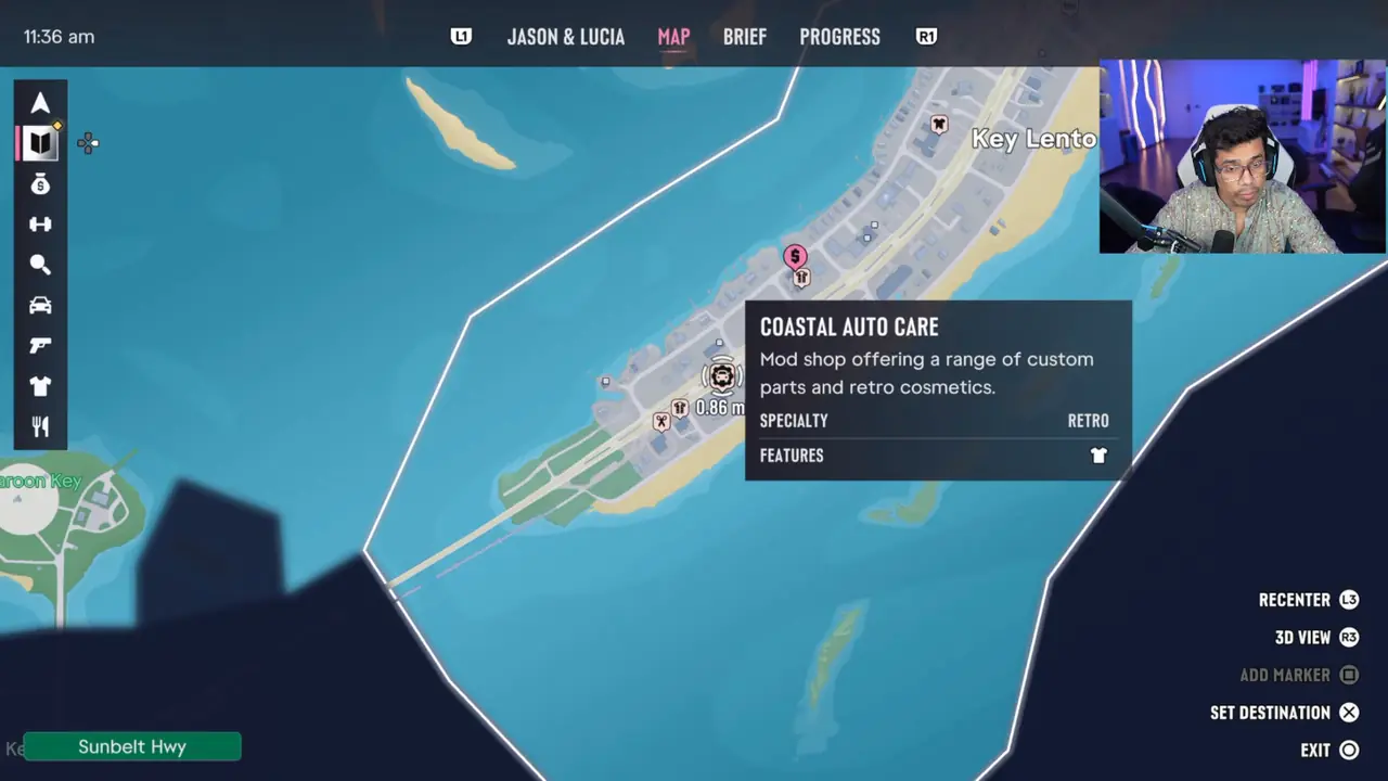
On PS5, the map sits on the touchpad by default (you can check it in the Control Scheme settings). Here's what you get:
- Four tabs: Jason & Lucia, Map, Brief and Progress. Switch with L1 and R1.
- Filters on the left: shops, gyms, vehicles, weapons, clothing and food, so you can hide clutter.
- Shop details: select a pin to see what it offers. Coastal Auto Care in Key Lento, for example, is a retro mod shop.
- Controls: L3 recenters, R3 swaps between 2D and 3D view, Square adds a marker and X sets a destination.
- Turn-by-turn GPS: the minimap shows prompts like "Keep Right, 328 ft (100 m)".
Our take
What we find interesting is that the GTA 6 map starts small on purpose. Key Lento is a tight, friendly place to learn the systems before Vice City opens up. We will update this page and our map as more of Leonida unlocks.
Bookmark it, and check our settings guide to pick the minimap style that suits you.
Frequently asked questions
Why is the GTA 6 map dark at the start?
The GTA 6 map starts locked. When the story begins, only the Key Lento area in Mariana County is open, and the rest of Leonida shows as dark county outlines. More of the map appears as the story moves on. CarryMinati's launch stream showed Vice City neighbourhoods a few hours in.
How big is the GTA 6 map?
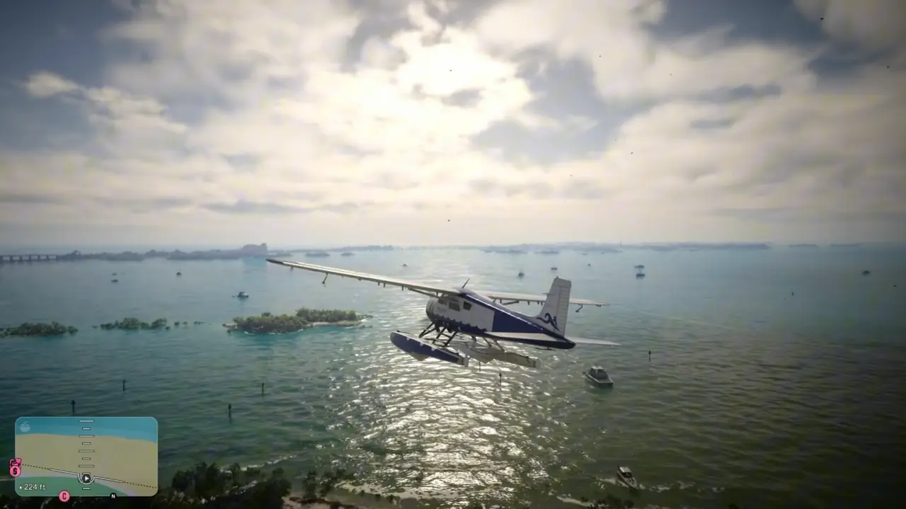
Rockstar Games has not published an official size for the GTA 6 map. Community comparisons put Leonida at roughly 1.5 to 2 times the size of GTA 5's map. YouTuber Will Mac needed about 15 minutes to fly a seaplane across the whole state on launch day.
Is GTA 6 based on Florida?
Yes. Leonida is a fictional take on Florida, and Vice City is its version of Miami. The regions mirror real areas, such as the Florida Keys, the Everglades and the Panhandle. Rockstar Games first used the Vice City name in 2002's GTA Vice City, which was also set in a Miami-style city.
Where is Mount Kalaga in GTA 6?
Mount Kalaga National Park sits in the north of Leonida, far from Vice City. It is the forested, quiet end of the map, built for hunting, fishing and trails. On Will Mac's launch-day flight it comes near the very end, and at least one viewer commented that they missed it.
Where is Hamlet in GTA 6?
Hamlet is a farm town at the southern end of the Leonida mainland, south of Vice City and just northeast of the Grassrivers wetlands. Fan mapping sites compare it to Homestead, Florida. Cottonmouth Lake, where players found Bigfoot on launch day, sits just south of the town.
Can you go inside buildings in GTA 6?
Yes, far more than in GTA 5. Reviewers at TheGamer describe explorable interiors across Leonida, including flea markets with working shops. The in-game map also marks mod shops, clothing stores, gyms and restaurants, so there are many more doors that actually open than in older Rockstar games.